A tale of three Johtos: the evolution of the Gen II maps
You can’t make a game on your first try, and sometimes not even on your second. While developing Pokémon Gold and Silver, Game Freak went through several designs for Johto, which have now been leaked. Looking at how the world map was refined over the years tells us a lot about the evolution of the game as a whole.
Part 2: Route 32-Route 37
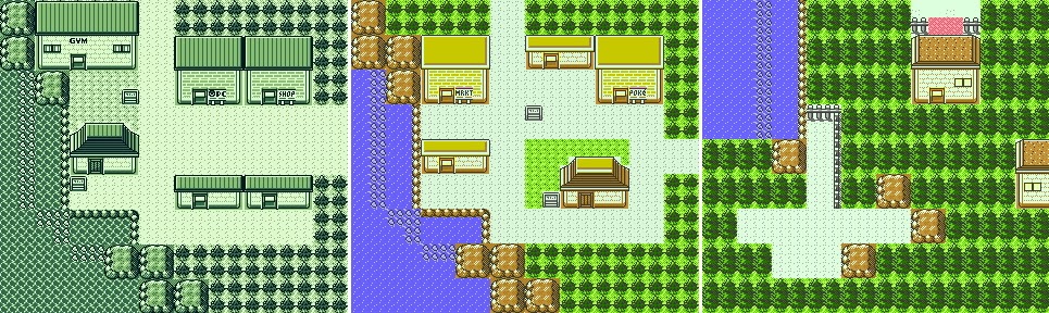
Southern Johto is probably the most heavily redesigned area in the map. While most towns and routes underwent large revisions, nothing compares to what happened in just a matter of three routes: a town was wiped out, another one was relocated, and an entire dungeon was moved to a completely different location.
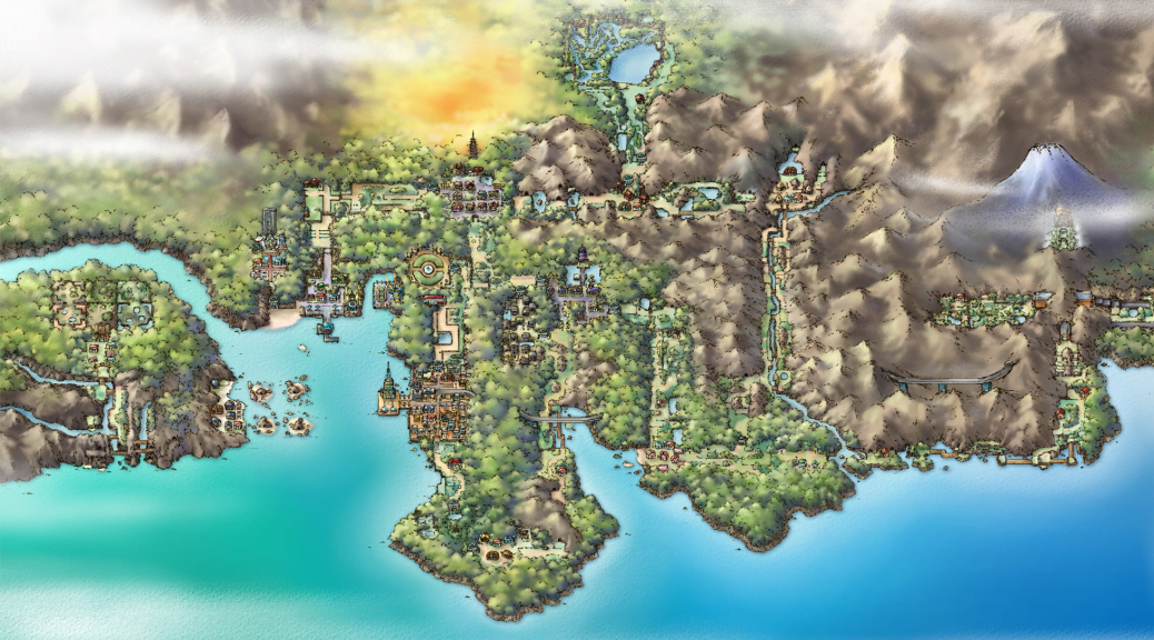
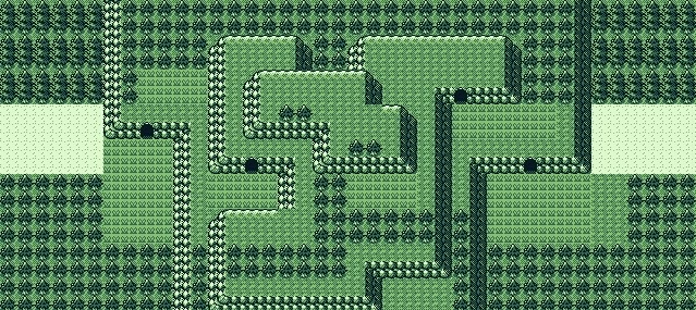
Route 32-a
Change level: Recognisable, but worse.
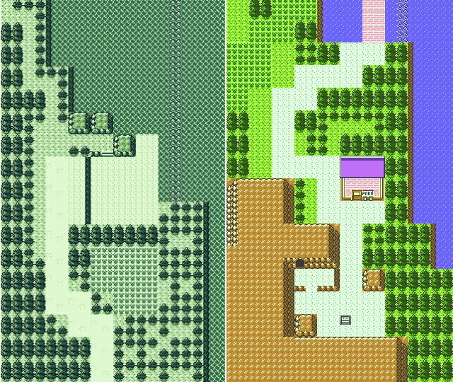
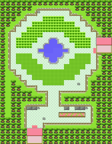
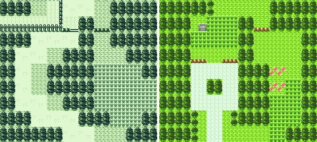
For now, let’s start with something simple. Since this route is just gigantic, I’ve cut it in two for ease of comparison – and because the two halves are drastically different in interest. It’s easy to see why the northern half is utterly boring: look at all that water. I’ve said that some old routes were bland, but this takes the cake.
Compare to the released version. This is better. So much better. You’ve got more Ruins of Alph, which, remember, didn’t exist at first. We have grass, room for Trainers, dual paths, a bridge, life. And double the room if you want to stick to dry land and walk on the left. Obviously, much of the water was cut and a couple of rocks were added, but the rocky boundaries on the right side of the sea are intact.
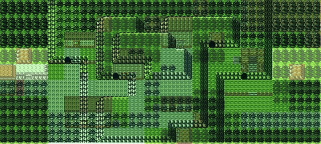
Route 32-b
Change level: If your memory is blurry enough, you may just miss the bridge. But oh boy.
And this is where things start becoming vastly different. First of all, before comparing it to the modern version, I need to point out one thing: the grass is so extremely out of the way you have to actually make an effort to walk through it. I don’t know whether it’d have been an improvement – after all, in Pokémon Sword and Shield they have mostly gone with that option, so you only encounter wild battles if you want to. But this patch of grass is so hilariously hard to even access, I don’t know what they were thinking when they designed it.
But now compare it to the final version:
Again, the shape is similar, the sea was downsized and the small beach that was in the original was used to place a Pokémon Centre, which, admittedly, is very convenient before crossing Union Cav–
Wait, where is Union Cave? Not here. Not yet. First you needed to make a stop at a mysterious town. The fun starts now.
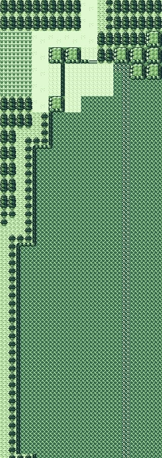
“Nara” Town/Route 33
Change level: Entirely redone from scratch.
Just look at this. A whole (tiny) town right before Union Cave! With its own Gym! Who knows, maybe you would have got a Fishing Rod in that house. Other than that, it looks much like the map in these times: barren and uninteresting. As The Cutting Room Floor notes, this was supposed to be Nara, a coastal town in Wakayama prefecture, in the southeastern corner of the peninsula that central Johto represents. So it makes geographical sense.
Of course, there’s little point in comparing it to the eventual Route 33. They aren’t even the same size!
At the very least, we can compare it to the mid-development version and see how it evolved before being scrapped.
And the answer is… very little. The gym was relocated, unblocking the way to Union Cave, and the water in the south was replaced by grassy terrain. All in all, a pretty forgettable town that was eventually moved aside so that Union Cave could appear earlier.
Incidentally, in the original game, the player was expected to get their third badge here. In the final version, you won’t get the second until the next map. The speed in which the game progressed was much faster initially.
And now, for the next great change.
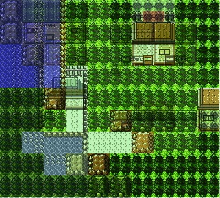
Union Cave/Azalea Town
Change level: The map was probably deleted.
I’m going to go with Union Cave as a name for this map because that’s how the dungeon we eventually got in this general side of the world is known, but, if you look at a real Japanese map, this was supposed to represent a series of mountains crossing the peninsula in southwest Honshu, including Mt. Gomadan, Mt. Obakko and Mount Shakka. To be fair, we know so little about this map that, game-wise, it could have been a completely different place. In fact, this mountain seems to branch upwards, instead of downwards, as the eventual Union Cave does. Other than that, the only thing we know is that Azalea wasn’t supposed to exist initially. Which begs another question: was Slowpoke Well even part of the game back then? Maybe you would have accidentally stumbled upon Team Rocket while exploring the cave, much as in Mt. Moon in Kanto. Or maybe the early plot was that much more different. We do know that the Radio Tower takeover was planned from the very first beta, but we don’t know about the rest of the story, after all.
Of course, comparing it to actual Azalea is pretty pointless. Supporting the “Azalea is a Cherrygrove edit” theory, there are absolutely no matches whatsoever between the two maps. Not the exits, not the entrances to any buildings, nothing at all. They probably just deleted this one entirely.
“Arida” Town/Route 34
Change level: The route itself is recognisable. The town was a complete surprise.
And finally, our last stop in the heavily redesigned southern Johto. If you look at a Japan map, just opposite Nara, crossing the mountain range we just talked about, you’ll find what looks like a sister town: Arida, a relatively small beach town south of Osaka (Goldenrod). That’s how the small town that used to be where Ilex Forest eventually ended up was called. This map had originally been believed to be a beta Cherrygrove – that enough tells you how much of a surprise it was. It had yet another gym (that’s the fourth, against two in the final version – a pretty front-loaded schedule) and a major house. Could that be Kurt’s? Or the Day Care? After all, it’s not up ahead, where it eventually landed. Meanwhile, the route itself looks as beautifully generic as everything so far, with a difference: there’s a looooong stretch of mandatory grass! They had been saving it all for this point.
If you compare the two versions, there is little else to comment, other than that the entrance to Goldenrod was changed from a gate to an open road, and that the Day Care now dominates the route. Hilariously enough, there’s no mandatory grass at all in the final version. I find that endearing.
If we compare the evolution of the town, we see that it remained mostly intact during revisions, except for the fact that it lost its Gym relatively early (even Nara’s survived longer) and the big house gained relevance. Eventually, though, they decided that having a forest would be more interesting, and deleted it. In the end, I think it was for the better: instead of having two samey small towns, we got a relatively bigger (and meatier) town and a forest, a different environment that appeared missing from the game in its original version.
This said, not all of Arida was lost. One landmark survived to this day, to tell the tale of what this map once was.
The southernmost rock.
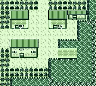
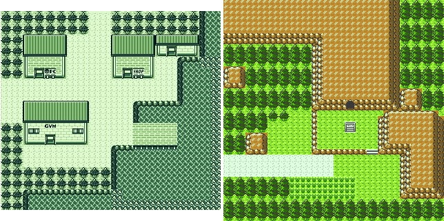
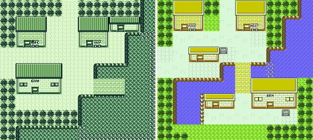
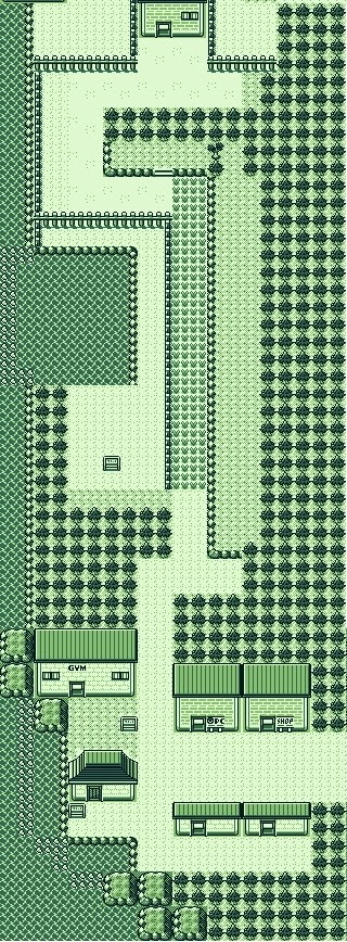
Goldenrod City
Change level: Extremely recognisable, although a few key places are missing.
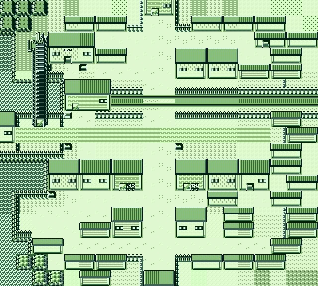
And, after all that mess, we finally get to a recognisable place: Goldenrod City. Even though it has changed quite a bit, it’s still very much its same self, with all those large buildings and the Radio Tower, which has remained in place ever since. A few things stand out from the original design: those door sprites look pretty cool. I’m not sure why the Gym and the house near the Mart don’t use them. Or why they didn’t survive, for that matter; they would have given the city a unique touch.
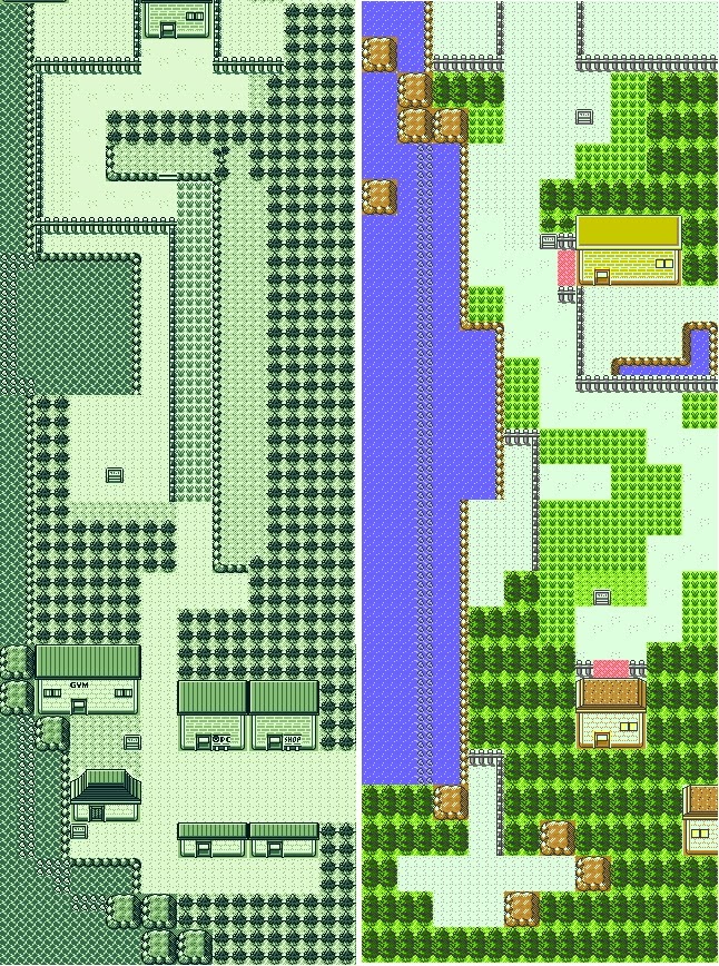
Of note is that the city used to have an exit to the west, leading to Olivine, as we’ll see later.
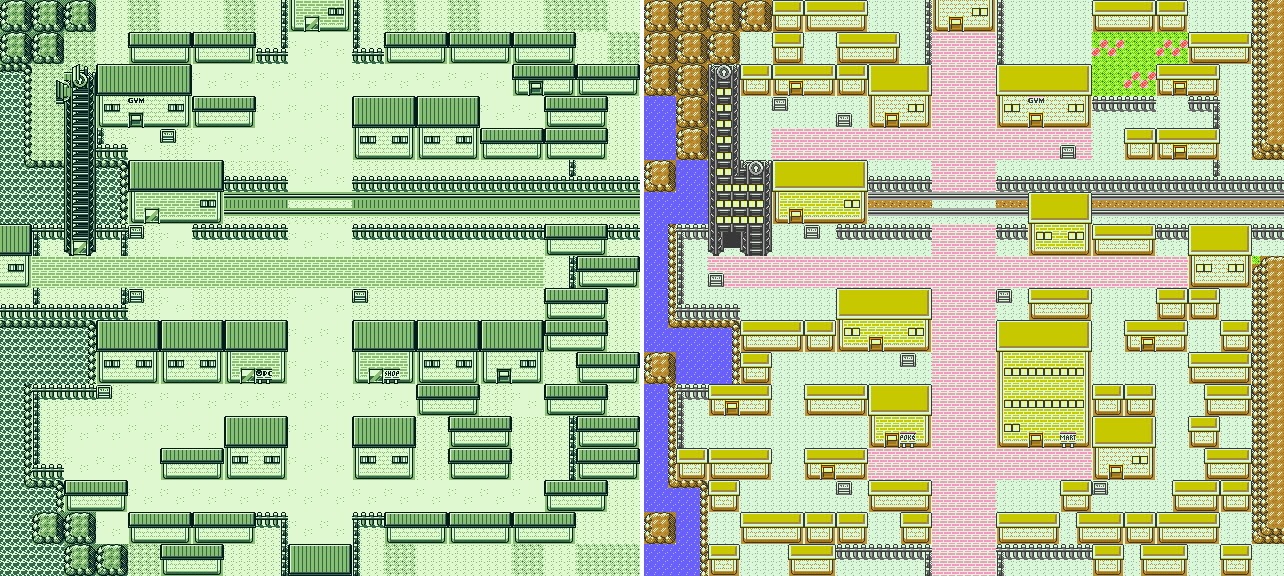
A comparison with the modern form shows some major changes but also some resilient areas. This is, perhaps, the city map that has survived with the fewest changes: the central horizontal road is almost intact, the Radio Tower just had three floors added on the right side, to fit the interior, and the train station wasn’t touched. The same goes for the Flower Shop (at least, assuming it was a Flower Shop back then): it’s still in the same place. On the other hand, more small buildings were added, giving it its distinctive maze-like organisation (and helping Team Rocket close down key zones during their takeover), the Gym was relocated and the Underground Path was opened. And, of course, the Mart evolved into a Department Store, also more fitting of a large metropolis. Meanwhile, the Casino seems to have been a late addition.
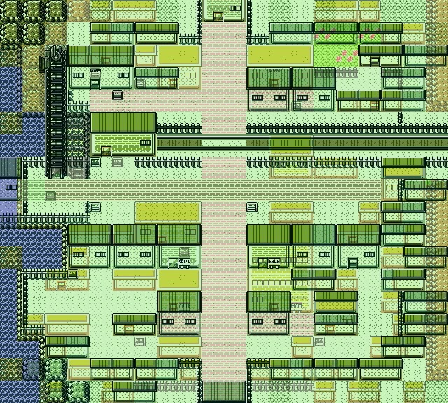
Still, the most remarkable fact of this map is how few major changes it suffered. To drive the point home, they didn’t even touch it for the “second version” maps, as we’ll also see happen to several upcoming towns. From here on, their first drafts suffered significantly fewer revisions than the previous areas.
Route 35
Change level: Recognisable.
So, here’s another case of a route that is basically the same self as before, but generally a bit worse than what we eventually got. This is a straightforward path to the National Park, so, yep. With a lake, check, and some optional grass, yep, everything in order.
Comparing it to its final form, we see that it’s basically the same: a zigzaggy path, trees and grass. Of course, in the modern version, the entrance to the National Park goes through a gate and there’s an alternate path to avoid it. And I like what they did with the hidden items behind the fences, which adds a little bit of exploration. But yeah, this map held up better than so many others.
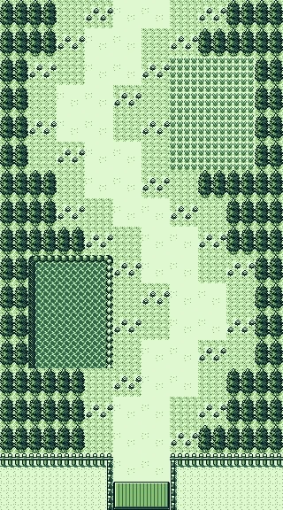
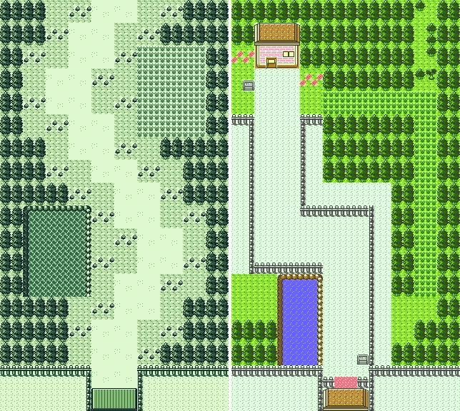
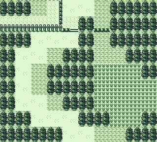
Route 36
Change level: Totally different, but it makes perfect sense in a hilarious way.
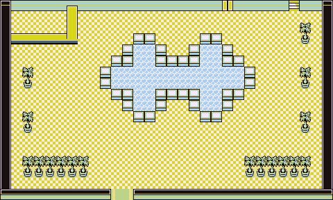
I love this map so much.
My dear friends, please behold the original National Park. This is beautiful and amazing and I’m so glad we managed to see this.
This is, I assume, their first attempt at creating it when they didn’t have an empty map available to them. And the fact that the map was rectangular and totally unsuited to their idea only makes it better. Look at those misshapen circles. Look at that tiny, sad bridge. It’s wonderful.
Of course, it’s pointless to make actual comparisons with their eventual counterparts, but I’m going to post a picture of the park anyway just so you can admire how much nicer the ball design looks when you have room (and a square map) to draw it. We might have only got one fountain instead of two, but it was so much better.
As a bonus, it’s worth pointing out how similar this design is to the fountains in the Silph. Co. ground floor. I guess this was their idea of “pretty decorative fountains”.
The comparison with the new map is pretty stark.
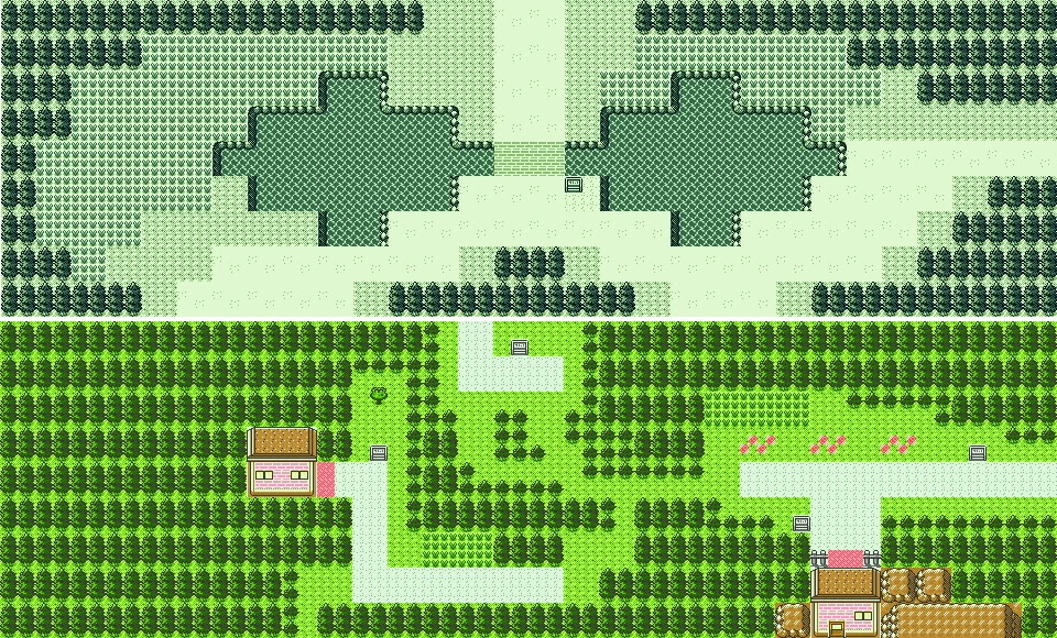
Likewise, comparing it to the eventual Route 36 tells us little. Okay, the trees are there. The entrance to Route 37 is pretty much in the same place, and so is the path to Violet. Everything else was obviously redesigned when the two giant eyes were no longer needed.
Incidentally, the old map is lacking a choke point for Sudowoodo, which makes me wonder how they would have stopped you from just walking into Ecruteak right away. Sudowoodo, likewise, didn’t exist yet in the early 1998 beta, when the pre-Johto map was used. Maybe it appeared later down the road and they decided to use it as a broken bridge once they redesigned this route. Still, the question remains: how would they stop you? Random dancers?
Oh, by the way, the empty area under the right lake is not an entrance to the Ruins of Alph – they didn’t exist yet, and that’s why they had to use gates in the final version, as the Ruins are a separate map, like a dungeon, and aren’t strictly linked to the main overworld. In the beta map, the area under that empty field was just supposed to be filled with ‘invisible-wall’ style boundary trees. This one is not the only map where this happens.
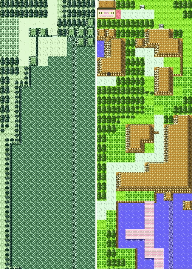
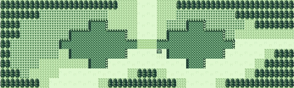
Route 37
Change level: Essentially the same
And, to end this exciting travel around very heavily modified areas, let’s look at the exact opposite.
This is essentially the same thing. The right grass was cut, the left ledges were moved, a signpost was added to tell you about hidden items, a tree was added for the twins (man, we didn’t have double battles back then, how awkward was that) and some mandatory grass was added just for fun. And that’s everything there’s to say about this small area.