A tale of three Johtos: the evolution of the Gen II maps
You can’t make a game on your first try, and sometimes not even on your second. While developing Pokémon Gold and Silver, Game Freak went through several designs for Johto, which have now been leaked. Looking at how the world map was refined over the years tells us a lot about the evolution of the game as a whole.
Part 3: Ecruteak City – Route 42
As a person who usually does Mahogany before Olivine, this section is going to have only two maps! Nah, just kidding. Still, I think it’s worth pointing out how Pokémon Gold and Silver allowed you to choose from two different paths after Ecruteak, something that has never happened again ever since in a series that has increasingly abused nonsensical roadblocks to keep you on track. And, looking at this beta design, you have to wonder if they were planning on making the world even more open-ended still – or if they were going to fill the whole map with random guys dancing across key roads for no reason.
Well, for now, let’s begin from where we left off.
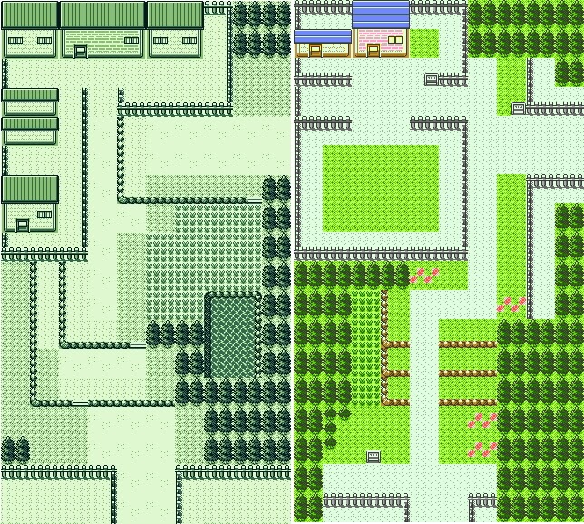
Ecruteak City
Change level: Some major redesigning happened, but the basics are already there.
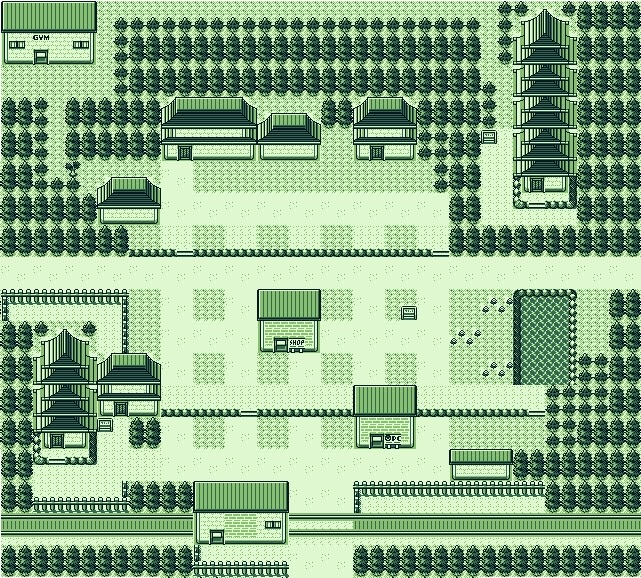
Ecruteak is yet another map that was left intact during the second revision, and was only remade for the final version. And yet, the amount of changes it underwent is staggering. First of all, in the original version, it was supposed to have a train station. But a station from and to where, exactly? After all, Ecruteak is north of Goldenrod, not east, as this design would suggest. Unless it was a different line to somewhere else, but that knowledge is probably lost. No other town or route that should be in the path of this line has a railway crossing it, so we can’t really tell anything. (Admittedly, there are no rails where the actual Magnet Train should run across, like Route 32, either, something that was only fixed in HGSS).
Moving on, the city looks pretty barren, with a Mart dominating the land and most major buildings tucked away in corners. We already see Tin Tower and a smaller one that could be Burnt Tower, not that it looks burnt. And Morty’s gym is in a pretty obnoxious location, likewise the path to Tin Tower. As we have seen time and again, they sure liked making some important places as annoying as possible to access.
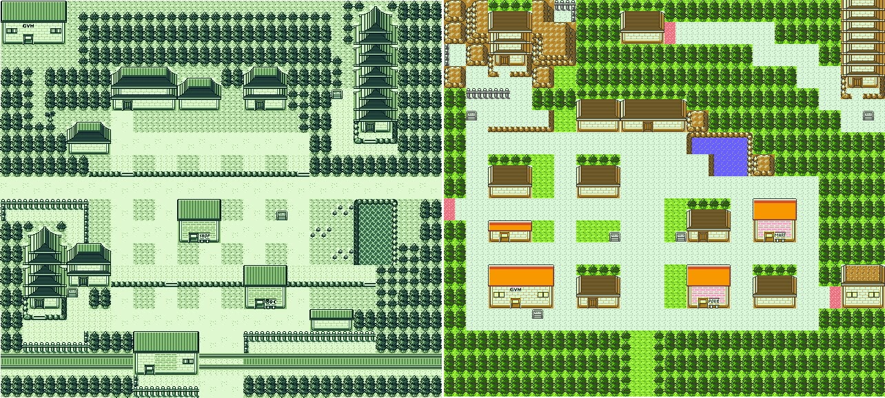
Comparing the maps shows the extent of the changes. The gym is mercifully rescued from its corner and swapped with the small tower. Now that I look at it from this angle, the diagonal symmetry of the towers perhaps works better than the horizontal one, but the final layout is so much more convenient. The buildings are spread out in a more rational pattern and there is an antechamber before accessing Tin Tower to save some annoying time cutting the bush and walking all the way around.
The redesign has also pushed down the entrances to the nearby routes, and probably caused them to replace the entrances with warps via gates.
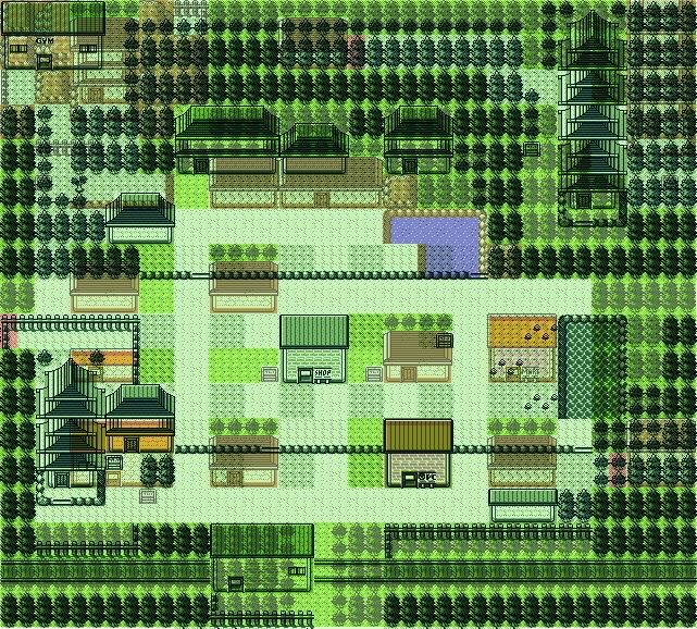
One last thing to point out: the Pokémon Centre has remained in place. It probably just travelled in time using its time capsule.
Route 38
Change level: Same idea, different execution.
This is a case in which I might prefer the beta version? I mean, it’s a bit blander, but it does its job pretty well: three different paths you can choose from: two with grass and one with trainers. A pretty solid design.
This version does the same… but kind of weirder. There’s a weird fenced path that doesn’t make much sense just to hide a tree behind a trainer, and the “open road” path is so tiny and uncomfortable. The only real advantage is that you can use the western ledges as a shortcut, but still. For once, I prefer the original!
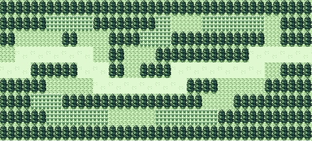
Route 39
Change level: Recognisable
Ah, yes, one of the most iconic routes in Johto, the one with Lon-Lon Ranch Moomoo Farm. The source of probably the most useful healing item in the series, on a HP per price ratio. Except this old version had far more buildings and far less room, especially because of that huge landmass on the top right surrounded by ledges and fences. It doesn’t help that the intersection between those two tiles looks really ugly. Also, the route is designed in a pretty weird way – the ledges make it so you only have to wade through the grass on the way back, not forward. That’s a decision. I guess it could make sense if, in the original plan, you were supposed to arrive in Olivine first from Goldenrod and then walk to Ecruteak through these routes, going the opposite way to the final version. But we can’t really know.
The final version rearranges the different areas into a better-looking path, in my opinion. And it lets you interact with the cows in the wild! So much better.
Olivine City
Change level: Someone put all the parts of the map inside a box and shook it.
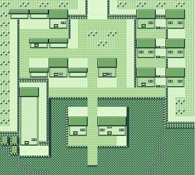
Look at that Lighthouse. They just drew a house and extended the top part for like 10 tiles. It’s amazing. I’ve seen vanilla rom-hacks with better designs than this. Shiny Gold tried harder than this (mandatory wave to Zel if he’s reading this).
Sorry, I just had to start with that. But! Olivine City! Another map that was left untouched for the first redesign… and then was completely remade for the final. The thing is, all the key areas are there. The Gym, the Lighthouse and exactly the same number of (used) buildings as in the original, just removing the ones they didn’t bother to fill in. The biggest missing building was the port from where SS. Aqua departs, which apparently didn’t exist back then. The plot might have been very different.
The major difference is that there is a surfing route that leads to Goldenrod, and that was obviously removed. Instead, a new route was added leading to Cianwood, which didn’t exist yet in this version. Considering that an unused house in Olivine talked about “the Pharmacy in Ecruteak”, it’s very likely that it was a fairly late addition.
My biggest question is: in which order did you get here? If Surf was still obtained in Ecruteak, as in the final, it makes sense that you would walk through routes 38 and 39 as well, instead of walking back to Goldenrod. But what was the point of the sea route then? Why would you need to go back to Goldenrod via surfing at that point? It is a shortcut, for sure, but flying is infinitely faster. And yet, the pier and the way the Gym is located would have made for a great first impression coming from Goldenrod. Whatever the case, they clearly decided there was little point to it and removed it.
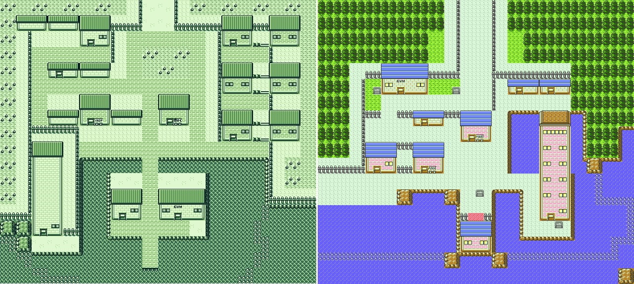
The final version is smaller and more compact, with all the useless empty buildings removed. Pretty much everything was relocated, save for the Pokémon Centre, and the Lighthouse was granted windows and a distinctive roof. And, of course, the southern route was replaced by a new western exit, heading to the newly added Cianwood. Really major renovations considering how little of the spirit of the city was changed.
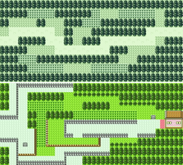
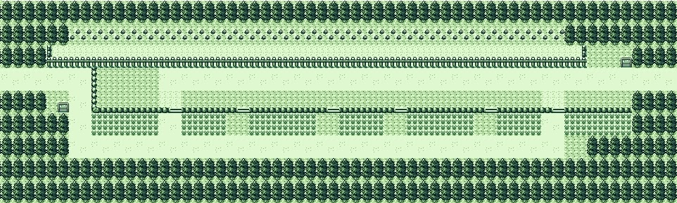
Routes 40-41
Change level: Removed for the final.
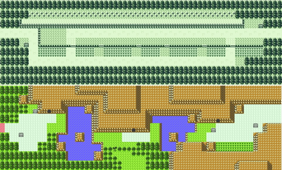
This straight line with boundary rocks was supposed to connect Olivine with Goldenrod. There is no exact equivalent in-game, neither in size nor in design, so the most likely possibility is that it was deleted and eventually replaced by a new sea route heading to last-minute Cianwood. And other than this historical curiosity, there isn’t really anything else to say about this thing, other than that it might possibly be the most lifeless route ever. Although I suppose there would be swimmers around, but come on, not even a few large rocks, or Whirl Islands (which didn’t exist yet I guess), not even a Fishermen island. Nothing.
And this is the intended connection with Goldenrod! Remarkable stuff. But the point stands: why did they do this? Was it just to fill room in the map? What was the original game plan? Maybe you were supposed to ride a small boat, like Mr. Briney’s, to get to Olivine. That would fit this straightforward design, but that’s just speculation.
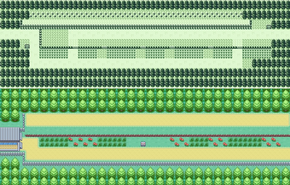
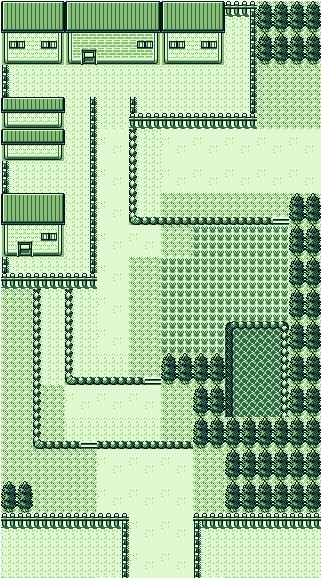
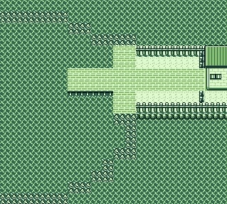
Route 42
Change level: What the hell.
Okay, you may be disappointed with those two last maps. They are fascinating, historic stuff that shows how much the map also changed in the western side and prove that Cianwood was a late-minute addition, and yet, design-wise, they are a nothingburger. Let’s go with something to make up for that.
Okay. Who is this and what did they do with Route 42.
This is absolutely stunning. Where is Mt. Mortar? Where are the lakes? There’s nothing of this left in the final map, other than a few boundary trees on the eastern side.
I can, I guess, imagine that, once Iwata helped them compress the game more efficiently, they decided to add dungeons, like Ilex Forest, the Whirl Islands or Ice Path, as we’ll see later, to routes that looked empty and bland. God knows the previous sea routes needed it, and this one certainly did.
This said, this route bears a resemblance to something else. I’ve no idea how that happened; perhaps this was just a placeholder while they came up with something better. But this looks as if a certain Southern Kanto Route had been accidentally warped to a new location.